
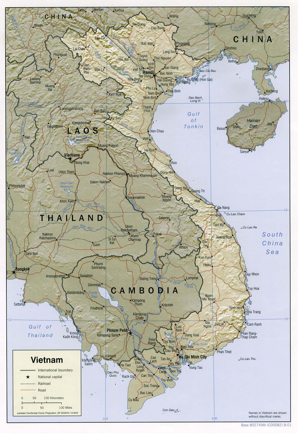
Vietnam Relief Map (Digital Copy of US Government Produced & Copyrighted Map)
| Author |
|
||||||||||||||||||||||
|---|---|---|---|---|---|---|---|---|---|---|---|---|---|---|---|---|---|---|---|---|---|---|---|
| Scale | Scale [ca. 1:7 000 000] ; Lambert conformal conic proj., SP 20 00N/12 40N (E 98°--E 110°/N 23°--N 8°) |
||||||||||||||||||||||
| Description | [Washington] : Central Intelligence Agency, [2001] 1 map : col. ; 24 x 17 cm. |
||||||||||||||||||||||
| Notes | Map of Vietnam showing international boundaries, national capitals, railroads, and roads. "Base 802749AI (C00082) 8-01" Relief shown by shading. |
||||||||||||||||||||||
| Subjects | Vietnam - Maps. | Vietnam - 2001. Relief Map |
||||||||||||||||||||||
In Copyright. You may copy under some circumstances, for example you may copy a portion for research or study. Order a copy through Copies Direct to the extent allowed under fair dealing.
|
|||||||||||||||||||||||
home | tours | company | stories | photos | readings | travel resources | other services | sign up
VeloAsia Cycling Adventures: ![]() © 1992-2019 VeloAsia
© 1992-2019 VeloAsia